This article delves into the transformative role of Copernicus data in European agriculture, highlighting its applications in crop mapping, monitoring biophysical parameters, phenology, yield estimation, and crop health assessment. Advanced data processing techniques, including image analysis and overlaying data layers using tools like SNAP and Earth Engine, are discussed to illustrate their potential in creating detailed agricultural maps and assessing soil health. The adaptability of these methodologies across diverse European regions and their impact on sustainable farming practices are emphasized. The article concludes by summarizing the significance of Copernicus data in enhancing agricultural productivity, informing policy development, and inviting collaboration for future innovation in this field.
By Dr. Javad Zarbakhsh, Cademix Institute of Technology
Introduction on Copernicus Data and Agricultural Analysis
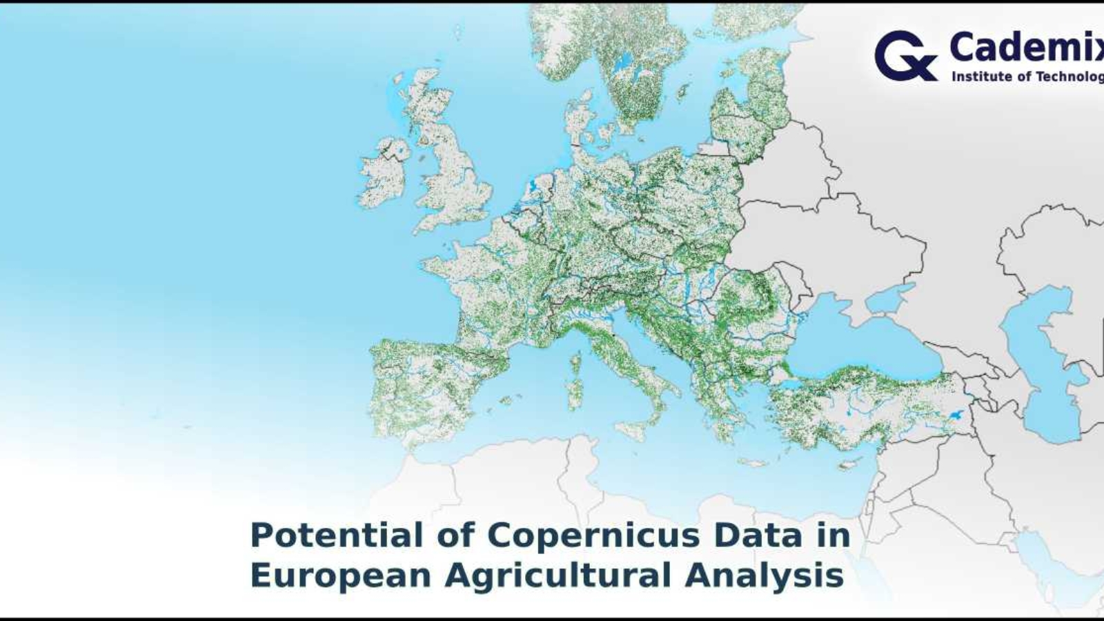
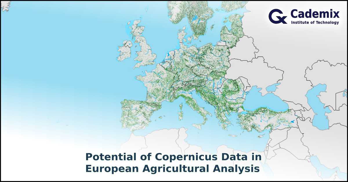
The Copernicus program, a cornerstone of Earth observation and monitoring, has become pivotal in reshaping modern agricultural practices. Initiated by the European Union and the European Space Agency, this program leverages a constellation of Sentinel satellites, providing critical data streams that hold immense potential for agricultural engineering and the broader agricultural industry. This data, characterized by its high resolution and frequency, has opened new horizons in agricultural monitoring, management, and policy-making.
From an agricultural engineering perspective, the Sentinel satellites of the Copernicus program serve as vital tools. These satellites offer an array of observational data, including high-resolution imagery and multi-spectral information, essential for advanced agricultural analysis. The Sentinel-1 and Sentinel-2 satellites, in particular, have been instrumental in providing data on crop biomass, land use, vegetation health, and moisture levels. These parameters are crucial for precision farming, a practice that optimizes inputs like water and fertilizer to enhance crop yield and sustainability.
The requirements of the agricultural industry are increasingly complex, driven by the dual challenges of ensuring food security and sustainable farming practices. In this context, Copernicus data becomes invaluable. It aids in efficient crop monitoring, helps in predicting yields, and plays a significant role in risk assessment, such as identifying drought-prone areas or regions susceptible to pest infestations. This data is not only beneficial for large-scale farming operations but also supports smallholders and local farming communities by providing insights that were previously inaccessible due to cost or technological limitations.
Furthermore, the Copernicus program’s role extends beyond just field-level applications; it has a significant impact on agricultural policy and decision-making. The data supports the implementation of policies like the EU’s Common Agricultural Policy (CAP), which aims to improve agricultural production while ensuring the sustainable use of natural resources. By providing objective and timely data, Copernicus helps in the transparent and effective administration of agricultural subsidies and supports evidence-based policy development.
Finally, the versatility of Copernicus data in agricultural applications is also seen in its integration with other technologies and data sources. When combined with ground-based observations and modern data processing techniques, such as machine learning and GIS analytics, the potential applications in agriculture multiply. This integration facilitates advanced analyses like predictive modeling, trend analysis, and scenario planning, which are vital for forward-looking agricultural strategies. As the agricultural sector evolves, the continued adaptation and integration of Copernicus data will be key in addressing the multifaceted challenges of modern agriculture.
Case Studies: Success Stories Across Europe
The practical implementation of Copernicus data in agricultural engineering is vividly illustrated through various case studies that demonstrate its transformative impact on the industry. One notable example is the research conducted in Saxony, Germany, during the 2018 drought, as documented in the Journal of Water and Climate Change. In this study, the High-Resolution Vegetation Phenology and Productivity Product (HR-VPP) from Copernicus was utilized to analyze crop land dynamics, showcasing the potential of satellite data in mitigating agricultural risks associated with extreme weather events [Ref]
Similarly, the role of Sentinel-2 data in supporting the EU’s Common Agricultural Policy (CAP) is another significant instance of Copernicus data application. As detailed in an article published by MDPI, this satellite data aids in monitoring agricultural subsidies, ensuring compliance and transparency in farming practices across the EU. This case study underscores the strategic use of remote sensing in policy implementation and agricultural governance. [Ref]
Further, a study from the ISPRS Archives emphasizes the use of Sentinel-1 and Sentinel-2 data for monitoring wheat crop growth parameters. This approach incorporates time-series analysis, leveraging the multi-spectral imaging capabilities of Sentinel satellites to provide in-depth insights into crop health and growth patterns, crucial for food security and sustainable farming practices [Ref].
The integration of Copernicus data with other technologies is highlighted in the EO4GEO project, where Sentinel imagery and Geographic Information Systems (GIS) data are combined for advanced agricultural applications. This project demonstrates the effectiveness of Copernicus data in crop mapping, monitoring biophysical parameters, and yield estimations, as reported in the ISPRS Archives. The EO4GEO project serves as a testament to the versatility of Sentinel data in addressing diverse agricultural needs [Ref].
Additionally, the utilization of Sentinel data for crop monitoring and agricultural subsidy control, as seen in the Czech Republic, offers a practical example of how free and open data streams from the Sentinels can be integrated with Member State’s geographical data infrastructure. This collaboration enhances the accuracy and efficiency of agricultural information dissemination, as detailed on the Copernicus EU website [Ref].
These case studies collectively highlight the breadth and depth of Copernicus data applications in agriculture. From drought monitoring and policy support to advanced crop health analysis and yield prediction, the use of Sentinel data represents a paradigm shift in agricultural engineering and management. The integration of this data with modern data processing and analysis techniques offers promising avenues for further advancements in the agricultural sector, meeting the complex demands of food security, sustainability, and environmental stewardship.
Potential Applications in Agriculture
The potential applications of Copernicus data in agriculture are diverse and significant, offering a range of solutions to enhance efficiency, productivity, and sustainability in the sector.
Crop Mapping: One of the fundamental applications is crop mapping. By leveraging the high-resolution imagery from Sentinel satellites, it is possible to delineate and classify different crop types across large areas. This application is vital for regional agricultural planning, crop diversity analysis, and assessing land use changes. For farmers, this translates to better crop rotation strategies and land use optimization, while for policymakers, it provides essential data for agricultural zoning and resource allocation.
Monitoring Biophysical Parameters: Copernicus data is instrumental in monitoring key biophysical parameters of crops, such as Leaf Area Index (LAI), biomass, and soil moisture. These parameters are critical indicators of crop health and growth progression. By analyzing this data, farmers can optimize irrigation and fertilization, leading to more efficient use of resources. For agronomists and agricultural engineers, this data assists in developing models for crop growth and predicting agricultural outputs more accurately.
Phenology Tracking: Understanding crop phenology – the study of periodic plant life cycle events – is crucial for timing agricultural activities. Sentinel data enables the monitoring of phenological stages like flowering and fruiting, which are critical for deciding the timing of irrigation, pest control, and harvesting. This precise timing is key to maximizing crop yields and quality, and is particularly beneficial in adapting to the changing climatic conditions.
Yield Estimation: Copernicus data aids in yield estimation by providing insights into crop conditions throughout the growing season. This information is invaluable for supply chain planning, market analysis, and food security assessments. For farmers, accurate yield predictions enable better financial planning and market positioning. For investors and insurers in agriculture, this data provides a basis for risk assessment and investment decisions.
Crop Health Assessment: Sentinel data’s capability to monitor crop health in real time is a game-changer. By identifying stress signs in crops, whether from pests, diseases, or environmental factors, timely interventions can be made. This proactive approach to crop health management minimizes losses and ensures the sustainable use of agrochemicals, aligning with the global push towards environmentally friendly farming practices.
In leveraging these applications, there is a need for innovative strategies and professional skills in Earth Observation (EO) and Geographic Information (GI) data analysis. Agricultural engineers and GIS specialists are required to interpret satellite data accurately and integrate it with ground-based observations. Skills in data analytics, remote sensing, and precision agriculture technologies are becoming increasingly vital in modern agricultural practices. Furthermore, the ability to translate this technical data into actionable insights for farmers and agricultural stakeholders is critical in realizing the full potential of Copernicus data in agriculture.
Advanced Data Processing and Image Analysis
Advanced data processing and image analysis are critical components in harnessing the full potential of Copernicus data for agricultural applications. The complexity and volume of data from Sentinel satellites necessitate sophisticated processing techniques to transform raw data into actionable insights.
Image Processing and Data Layer Overlay: At the core of these techniques is image processing, crucial for extracting meaningful information from satellite imagery. This involves steps like image correction, classification, and enhancement. Overlaying different data layers, such as soil moisture, vegetation indices, and topographic data, provides a comprehensive view of agricultural landscapes. This multi-dimensional analysis aids in precise crop monitoring and land management, offering a more nuanced understanding of the agricultural ecosystem.
Use of SNAP and Earth Engine Software: Tools like the Sentinel Application Platform (SNAP) and Google Earth Engine play a pivotal role in processing and analyzing satellite data. SNAP, specifically designed for Sentinel data, offers functionalities for data processing, analysis, and visualization. Google Earth Engine, on the other hand, excels in large-scale geospatial data analysis, leveraging cloud computing. These tools are indispensable for researchers and agricultural professionals in conducting detailed analyses ranging from crop classification to change detection over time.
Creation of Detailed Crop Maps: One significant application is the creation of detailed crop maps. By processing multi-spectral images from Sentinel-2, for instance, different crop types can be identified and mapped with high accuracy. These maps are essential for regional agricultural planning, helping to optimize land use and monitor crop diversity.
Assessing Soil Health: Advanced image analysis also facilitates the assessment of soil health. Parameters like soil moisture content, organic matter levels, and potential erosion risks can be estimated using Sentinel data. This information is vital for sustainable land management, guiding decisions on crop rotation, irrigation, and soil conservation practices.
Identifying Sustainable Farming Practices: Furthermore, the integration of Copernicus data with other environmental data through advanced processing techniques can help identify and promote sustainable farming practices. For example, analyzing vegetation health over time can provide insights into the effectiveness of different farming techniques on crop yield and environmental impact.
For now, the advanced processing of Copernicus data, particularly through image analysis and the integration of various data layers, is a cornerstone in modern agricultural engineering. It enables a deeper understanding of agricultural systems, empowering farmers, policymakers, and investors with the knowledge to make informed decisions. As the agricultural sector continues to evolve amidst technological advancements and environmental challenges, the role of sophisticated data processing and analysis in ensuring sustainable and efficient agricultural practices becomes increasingly paramount.
Future Perspectives and Development
The future of agricultural engineering, guided by the insights from Copernicus data, is poised for significant transformation. The potential to extend these analyses to other regions in Europe is immense, opening new avenues for agricultural productivity and sustainability.
Extending Analyses to Other Regions: The adaptability of Copernicus data allows for its application across various European landscapes, each with its unique agricultural challenges. The success stories in regions like Germany and Poland serve as templates that can be tailored to other European regions. This involves adjusting the data processing algorithms to accommodate local climatic conditions, crop types, and farming practices. By doing so, regions that have not yet leveraged this technology can gain insights into efficient land use, crop health monitoring, and yield optimization.
Adaptation to Local Agricultural Contexts: Adapting these methodologies to local contexts is crucial. This requires a deep understanding of regional agricultural practices and environmental conditions. For instance, in areas with high smallholder farmer populations, Copernicus data can be used to develop solutions tailored to small-scale farming, focusing on crops and practices prevalent in those areas. Additionally, in regions with intensive farming, the data can aid in precision agriculture practices, optimizing resource use and reducing environmental impacts.
Continuous Innovation in Data Processing: The field of agricultural engineering must emphasize continuous innovation in data processing techniques. As computational capabilities evolve, so too should the methods of analyzing satellite data. This includes the integration of artificial intelligence and machine learning for predictive analytics as we focus in Cademix Institute of Technology, offering more nuanced and forward-looking insights into agricultural practices. Such advancements can revolutionize how data is used for crop health monitoring, pest detection, and climate impact assessments.
Enhancing Agricultural Productivity and Sustainability: The ultimate goal of these advancements is to enhance agricultural productivity while maintaining sustainability. Innovative data processing techniques can lead to more precise farming methods, reducing wastage of resources and minimizing environmental footprints. For instance, detailed soil health assessments can inform sustainable soil management practices, while advanced crop mapping can aid in biodiversity conservation.
Collaborative Efforts for Development: The future developments in this field also hinge on collaborative efforts between computer scientists, GIS experts, agricultural engineers, and farmers. By working together, these stakeholders can ensure that the technological advancements are not only scientifically sound but also practically applicable and beneficial to the agricultural community.
Therefore the future of agricultural engineering, fueled by Copernicus data, is one of innovation, adaptability, and sustainability. As these methodologies extend across Europe and adapt to local contexts, the agricultural industry stands to benefit immensely from enhanced productivity, resource efficiency, and environmental stewardship. The continuous evolution of data processing techniques will play a pivotal role in realizing these benefits, marking a new era in agricultural practices.
Conclusion
The transformative potential of Copernicus data in European agriculture is both vast and multifaceted. This satellite-driven data stands as a pivotal resource in revolutionizing how we approach farming, from the minutiae of crop health monitoring to the broader strokes of agricultural policy and land management.
Transforming Agricultural Practices: At the heart of this transformation is the ability of Copernicus data to enhance agricultural practices. With precise crop mapping, detailed biophysical parameter monitoring, and advanced phenology tracking, farmers and agricultural engineers can make informed decisions that boost productivity while preserving environmental health. These capabilities extend beyond just practical farming applications; they also serve as critical tools in tackling broader challenges like food security, climate change adaptation, and sustainable land use.
Influencing Policy and Decision-Making: Beyond the fields, Copernicus data plays a crucial role in shaping agricultural policies and decision-making processes. By providing objective, up-to-date information on various aspects of the agricultural landscape, this data supports the development of policies that are both effective and responsive to the changing needs of the agricultural sector. This is particularly evident in the implementation of the EU’s Common Agricultural Policy, where satellite data has streamlined processes and enhanced transparency.
In summary, the integration of Copernicus data into European agriculture is not just an advancement in technological application; it’s a leap towards smarter, more sustainable farming and informed policymaking. This synergy of data science, GIS expertise, and agricultural know-how opens doors to a future where farming is not only more efficient and productive but also more in tune with the environmental and economic needs of our time.
As we at Cademix Institute of Technology continue to explore and expand the applications of Copernicus data in agriculture, we invite collaboration, questions, and proposals for joint projects. Whether you are a farmer seeking to optimize your practices, an investor looking to contribute to sustainable agriculture, or a researcher with innovative ideas, your insights and inquiries are invaluable in this journey towards a more advanced and sustainable agricultural future. Get in touch to explore the myriad possibilities that Copernicus data offers and be a part of this exciting agricultural evolution.